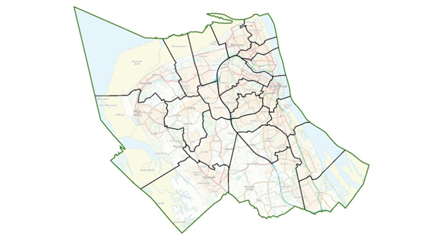
A new political map for Wirral Council

Wirral Council is set to have new boundaries for its council wards.
The Local Government Boundary Commission has published final recommendations for changes in Wirral Council.
It says residents should be represented by 65 councillors. This is one less councillor than the current arrangements.
The Local Government Boundary Commission is the independent body that draws these boundaries. It reviewed Wirral Council wards to make sure councillors will represent about the same number of electors, and that ward arrangements will help the council work effectively.
The changes mean there will be 21 three-councillor wards, and one two-councillor ward. The boundaries of most wards will change.
Publishing the recommendations Professor Colin Mellors, Chair of the Commission, said:
We are very grateful to people in Wirral. We looked at all the views they gave us. They helped us improve our earlier proposals. We believe the new arrangements will deliver electoral fairness while maintaining local ties.
93 people and organisations made comments to help decide the new wards. Changes in response to what local people told The Commission include:
• West Kirby & Thurstaston and Hoylake & Meols wards have been revised to ensure all West Kirby town is included in a single ward. As a result, Hoylake & Meols ward will now have two councillors instead of three.
• Minor boundary changes were made to Birkenhead & Tranmere, Bromborough & Port Sunlight, Oxton, Prenton, and Rock Ferry & New Ferry wards based on local evidence.
The Commission has made further changes to its earlier proposals. Details can be found on its website at: Wirral | LGBCE
The changes become law once Parliament has approved them, following which arrangements for the revised wards boundaries will be put in place for the May 2027 elections.